
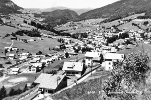
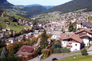
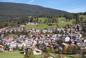
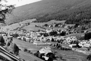
Das Dorf St. Ulrich nach Westen (1950er Jahre und 2007)
|
|
| © Fotoarchiv Albert Moroder | © Christine Wanker |
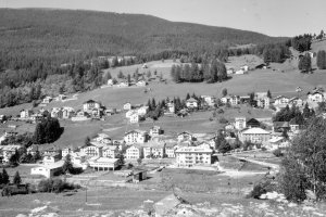
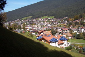
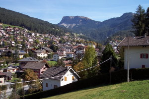
Blick vom Hotel Waldrand (Gemeinde Kastelruth) nach St. Ulrich mit Col de Flam und Raschötz im Hintergrund (1950er Jahre und 2007)
|
|
| © Fotoarchiv Albert Moroder | © Christine Wanker |
St. Ulrich von Überwasser (Gemeinde Kastelruth) gegen Nordwesten (1950er Jahre und 2007)
|
|
| © Fotoarchiv Albert Moroder | © Christine Wanker |
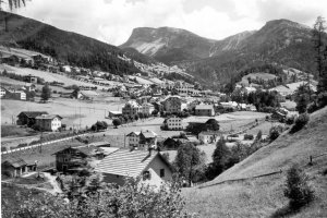
St. Ulrich mit Blick auf Seceda (um 1930 und 2007)
|
|
| © Autonome Provinz Bozen-Südtirol, Abt. 14, Amt für audiovisuelle Medien, Fotograf Leo Bährendt | © Christine Wanker |
[ nach oben ]
© Universität Innsbruck | Impressum | Aktualisiert am: 22.12.2008