
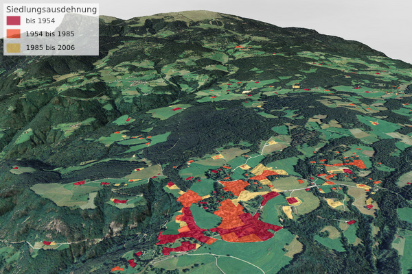
Siedlungsentwicklung - Oberbozen, Klobenstein und Unterinn
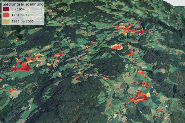
Bearbeitung: Dusleag & Wanker; Datengrundlage: Autonome Provinz Bozen - Südtirol, Raumordnung; Informationen zur Siedlungskartierung (html | pdf)
Siedlungsentwicklung - Klobenstein
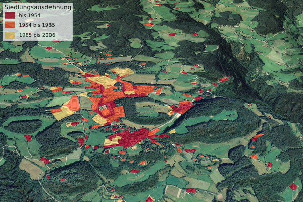
Bearbeitung: Dusleag & Wanker; Datengrundlage: Autonome Provinz Bozen - Südtirol, Raumordnung; Informationen zur Siedlungskartierung (html | pdf)
Siedlungsentwicklung - Gewerbezone bei Klobenstein
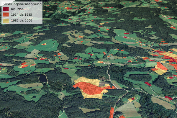
Bearbeitung: Dusleag & Wanker; Datengrundlage: Autonome Provinz Bozen - Südtirol, Raumordnung; Informationen zur Siedlungskartierung (html | pdf)
Siedlungsentwicklung - Unterinn
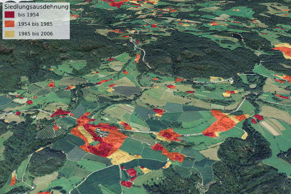
Bearbeitung: Dusleag & Wanker; Datengrundlage: Autonome Provinz Bozen - Südtirol, Raumordnung; Informationen zur Siedlungskartierung (html | pdf)
Siedlungsentwicklung - Oberbozen
© Universität Innsbruck | Impressum | Aktualisiert am: 22.12.2008