
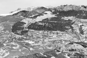
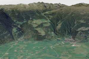
Mals und Tartsch (1954-1956 und 2006)
|
|
|
| Bearbeitung: Dusleag & Wanker, Datengrundlage: Autonome Provinz Bozen - Südtirol, Raumordnung | ||
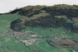
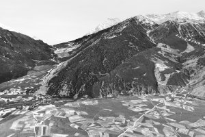
Schleis und Burgeis (1954-1956 und 2006)
|
|
|
| Bearbeitung: Dusleag & Wanker, Datengrundlage: Autonome Provinz Bozen - Südtirol, Raumordnung | ||
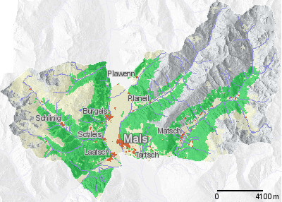
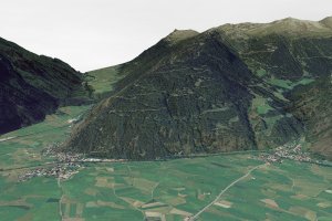
Laatsch und Schleis (1954-1956 und 2006)
|
|
|
| Bearbeitung: Dusleag & Wanker, Datengrundlage: Autonome Provinz Bozen - Südtirol, Raumordnung | ||
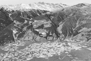
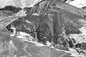
Alsack und Ulten (1954-1956 und 2006)
|
|
|
| Bearbeitung: Dusleag & Wanker, Datengrundlage: Autonome Provinz Bozen - Südtirol, Raumordnung | ||
[ nach oben ]
© Universität Innsbruck | Impressum | Aktualisiert am: 22.12.2008