Tirol Atlas Archive

^UP
Radfeld (Tyrol) Wikipedia Link *
*
District: Kufstein
NUTS-3 area: Tiroler Unterland
Arms: None
Basic data
Altitude512m
Population, 12/31/20132322
Area14.3 km²
Settled area6.8 km²
Overnight stays of tourists 2009/201064307
 
Fact sheets
Agriculture - Population - Tourism (time series) - Tourism (enterprises) - Sports facilities - Economy - Elections - Area
 
Natural environment
Satellite image (80x80km)
Altitude distribution (help)
potential sunshine duration january till december (3MB video - legend)
Corine Land Cover
topographic map
 
Neighbours
Breitenbach am Inn, Brixlegg, Kramsach, Kundl, Rattenberg, Wildschönau
 
<-   ->
Foto
to view the images you need a dom-capable browser

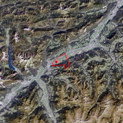
Radfeld - a typical ribbon development - starts at the city walls of Rattenberg. Impressive farmhouses and numerous new houses follow the more than 2 km long road. New developments have also been built away from the road. Radfeld, which is situated between the highway and the railroadpopulation, has tripled within the last 50 years. Some decades ago people lived from agriculture and tourism. Today more than 1000 people from Radfeld and its surroundings work for one of the 80 new developed companies, including one high-tech company. The transport sector plays an important role in Radfeld.


Keyword search: