Tirol Atlas Archive

^UP
Amlach (Tyrol) Wikipedia Link *
*
District: Lienz
NUTS-3 area: Osttirol
Arms: None
Basic data
Altitude687m
Population, 12/31/2013413
Area22.5 km²
Settled area1.1 km²
Overnight stays of tourists 2009/201047597
 
Fact sheets
Agriculture - Population - Tourism (time series) - Tourism (enterprises) - Sports facilities - Economy - Elections - Area
 
Natural environment
Satellite image (80x80km)
Altitude distribution (help)
potential sunshine duration january till december (3MB video - legend)
Corine Land Cover
topographic map
 
Neighbours
Leisach, Lesachtal, Lienz, Tristach
 
<-   ->
Foto
to view the images you need a dom-capable browser

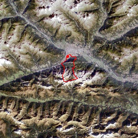
Amlach, at the foot of the forested Rauchkogel Mountain, is situated at the southern edge of the Lienzer Basin, close to the Lienzer Dolomites Mountain Range. The village consists of the long stretched settlement of Amlach and the hamlet of Ulrichsbichl in the east. Amlach, far from the main road, has managed to preserve its small, quiet, rural character by far the best from all villages within the Lienzer Basin. An increase in population figures and developments has been limited and so Amlach is still characterized by rural farming life.


Keyword search: