Image collection »Gschnitz«
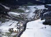
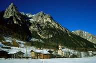
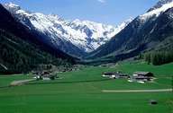
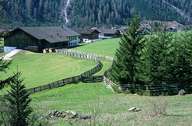
Gschnitz is situated in the southwestern part of the Gschnitztal that meets the Wipptal at Steinach am Brenner. Gschnitz is surrounded by massive summits: Habicht (3277 m) in the north east, Kirchdachspitze in the north and the Tribulaun Mountain Range in the south, formed by light limestone. Gschnitz was inhabited in the Middle Ages, when detached farmhouses were built in clearings. Only in the 18th century, a hamlet formed around the parish church - today's centre. Within the last decades new developments have led to an increase in the density of houses. Since World War II buses have operated in Gschnitz, leading to some tourism (mountain biking, and hiking) and the beginning of commuting.
|
|
|
|
|
|