Image collection »Bletterbachschlucht«
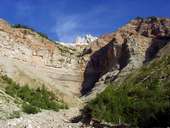
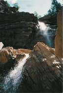
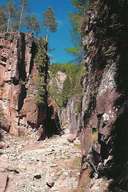
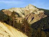
The Bletterbachschlucht is located at the foot of the Weißhorn and is the biggest gorge in South Tyrol. Since the last ice age, some 15,000 years ago, the Bletterbach has cut its way into the substrata over a length of about 8 kms and in this way formed a canyon up to 400 m deep. The exposed rock formations reveal 20 million years of earth history ranging from the Paleozoic to the Mesozoic periods. The rock layers lie almost intact on top of each other and contain a wealth of reptile tracks and fossils. The Bletterbachschlucht, as the Geoparc Bletterbach, has been made accessible through a nature trail that starts at the car park at Lahneralm. There is also a visitors' centre in Aldein and the Geomuseum in Radein. While the gorge attracts mainly tourists nowadays, in the 16th century it attracted miners. In their search for copper ore, they cut some galleries into the rock but these mining activities were not very profitable.
|
|
|
|
|
|