Image collection »Mittleres Etschtal«
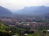
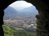
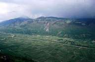
The Mittleres Etschtal starts near Töll-Plars and stretches 24 km till Castle Sigmundskron southwest of Bozen. The steep slopes, which run along the flat bottom of the valley, consist of Bozner quartz-porphyry. The Tschögglberg and the Tisener Mittelgebirge lie above the valley. The area between Meran and Bozen is densely populated. The bottom of the valley is no longer characterized by fields, but by pastures and extensively used orchards. However, more and more land is used for intensive fruit-growing. Most of the people earn their living in the service sector. The villages have changed drastically since the 1950s. The former rural communities have turned into large settlements, in which the former rural character is about to disappear.
|
|
|
|
Further links: Hazards Chronicle Tyrol, Weblink »Wikipedia«