Image collection »Antholz«
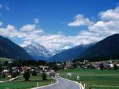
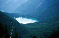
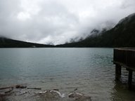
The tributary valley of Antholz stretches for 15 km north of Olang. In the valley several rock slides with their debris fans retained water forming lakes. Today high moors indicate the places of the former lakes. One of these moors is the so called "Rasner Mösern" (35 hectares). The only lake which still exists today in the valley is the Antholzer See. This lake (with its 44 hectares it is the third largest natural lake in South Tyrol) was formed by debris fans deposited by rock slides on either side of the valley. The earliest settlements most likely date back to the time when the bishops of Brixen started to colonize the valley. The valley lies in the transmission zone between the old gneiss and the Riesenferner tonalite.
|
|
|
|
Further links: Hazards Chronicle Tyrol