Image collection »Zillertal«
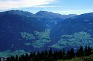
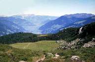
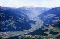
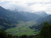
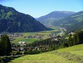
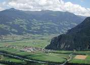
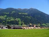
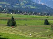
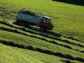
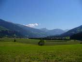
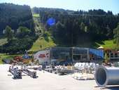
The broad Zillertal with its entire catchment area is the biggest and most populous side valley of the Inn and runs from the south into the Inn at the same elevation level at Strass. The valley stretches as far as Mayrhofen where it branches out into the high valleys also referred to as the "Gründe". The valley is drained by the Ziller which in Roman times marked the border between the Roman provinces of Noricum in the east and Raetium in the west. Nowadays the Ziller forms the border between the diocese of Innsbruck and the archbishopric of Salzburg. The different colours of the church spires in the border area indicate to which one a parish belongs (red = Innsbruck, green = Salzburg). The valley with its settlements which have lost their individual identity through tourism, trade and industry was once characterised by scattered villages on the alluvial fans of the side valleys. The individual farm settlements which reach high up on the slopes gradually give way to continually used mountain pastures. The soft rocks of the quarzphyllite and grauwacken zone favour mountain farming. Apart from the very strong orientation towards tourism (summer and winter) in the valley, dairy farming also plays an important role through intense cattle farming. Since 1901 a (narrow gauge) railway, driven partly by steam, runs between Jenbach and Mayrhofen.
|
|
|
|
|
|
|
|
|
|
|
|