Image collection »Unterinntal«
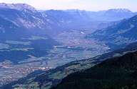
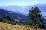
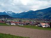
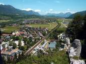
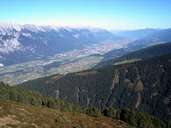
The Unterinntal stretches from the confluence of the Melach in the Inn at Kematen to the frontier at Erl. Over a distance of about 90kms the difference in altitude is about 100 metres. In the Unterinntal to east of Pill the Inn divides the northern Kalkalpen from those in their core higher Zentralalpen. Further downstream the geological picture changes: an increasingly broader grauwacken zone pushes itself in an easterly direction between the Nördliche Kalkalpen and the Zentralalpen. The processes during and after the last ice age, which reached their climax approx. 20.000 years ago, were crucial in shaping the Inntal. While the glaciers receded the valley was filled with a mighty layer of debris into which the Inn gradually cut its course and formed the present broad valley floor. Remainders of the former valley floor can be found on both sides of the Inntal on the so-called Mittelgebirge terraces. As the main economic, transport and industrial area of the province the Unterinntal has experienced an enormous increase in settlement density over the last decades which can be seen in the blending of individual settlements and in some places complete settlement bands, above all in the central area around Innsbruck.
|
|
|
|
|
|