Image collection »Obernbergtal«
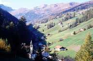
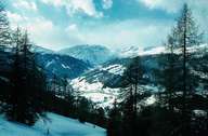
The Obernbergtal which runs in an west-east direction begins at the foot of the limestone Obernberger Tribulaun. The source of the Seebach, which drains the valley, rises in the delightful Obernberger See at the heart of the valley. The valley floor, made up of quarzphyllite is generally even and it is only at the end of the valley that the Seebach falls just under 200m in a narrow V-shaped valley down to the Wipptal at Gries am Brenner. The scattered settlements are located on the valley floor and rise to an altitude of 1550m on the sunny slopes. Extensive mountain meadows and pastures form the economic basis for the farms which were established in the High Middle Ages. In the 14th and 15th centuries mining was the most important economic factor in the valley and marble from Obernberg was also used for the tombstone of Emperor Maximilian in the Hofkirche in Innsbruck.

|

|
|
