Image collection »Oberinntal«
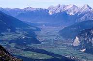
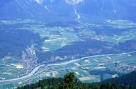
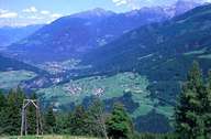
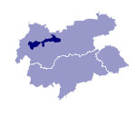
The Oberinntal (excluding the Oberes Gericht) runs for about 90kms from Landeck up to where the Melach, which flows from the Sellraintal, runs from a southerly direction into the Inn at Kematen. The course of the Oberinntal is marked by alternating gentle valley sections with an even valley floor and gorge-like narrow stretches and is accompanied by almost 3000m high steep mountains. More marked than in the Unterinntal the Oberinntal forms a clear boundary between the Kalkalpen and the Zentralalpen both tectonically and geologically. On its course through the Oberinntal the Inn overcomes a difference in height of about 200m. The narrow stretch at Finstermünz is followed by that at Fließ - both still in the Oberes Gericht - then that at Zams and the Roppener Riegel. The last narrow stretch between Unterperfuß and Martinsbühel also forms the boundary to the Unterinntal in the following also referred to as the Mittleres Inntal. The location of the Oberinntal between high mountain ranges, which protect it from the north-west weather, corresponds to a dry climate (rainfall everywhere under 1000m). The settlements are village-like and densely built with few individual farms. The farmland is more segmented here than in the Unterinntal which is due to many years of partitioning due to inheritance laws.

|

|

|
|
