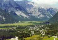
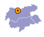
Image collection »Leutasch«
As in the case of the Seefelder Senke, Main Dolomite and Wetterstein Limestone are dominant in Leutasch. The first settlements date back to the forest clearances carried out in the 12th century by the monasteries of Wilten and Pollingen near Weilheim. Settlements and individual farms grew up on the side terraces. The valley used to be used as pastureland by the farmers of the Inntal. Due to the isolation of the valley, subsistence farming dominated for centuries. Apart from cattle farming there was also arable farming (barley, rye, flax). Many farmers from the Leutasch had fields in the Inntal which they used to grow maize. Since the mid-20th century tourism has become an increasingly important economic factor in the Leutasch.

|
|
