Image collection »Pfitscherbach«
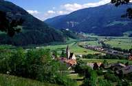
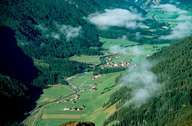
The Pfitscherbach has its source in the Zillertaler Alps and runs through the Pfitscher Valley. In its upper reaches its water is stored in a reservoir from which the water is used to generate electricity. At Sterzing the Pfitscherbach flows into the Eisack. Kematen and Wiesen are the largest settlements within the Pfitscher Valley.
|
|
|
Further links: Hazards Chronicle Tyrol, Weblink »Wikipedia«