Image collection »Rosanna«
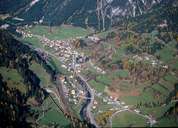
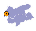
The Rosanna has its source within the Verwallgruppe near the Muttenjoch. The river runs through the Stanzer Valley and through villages well known among tourists, such as St. Anton, Pettneu and Strengen. The Rosanna meets the Trisanna forming the Sanna east of Strengen. Travelling through the Stanzer Valley one reaches the Arlberg and Vorarlberg.

|
|
