Image collection »Ahr«
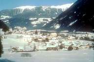
The Ahr has its source in the glaciers of the Hohe Tauern. It first runs through the Ahr Valley, where the river has a significant decline. After running through the Ahr Valley the Ahr runs through the Tauferer Valley with its wide bottom and flows into the Rienz near Bruneck.
|
|
Further links: Hazards Chronicle Tyrol, Weblink »Wikipedia«