Tirol Atlas Archiv

tiroLexikon

^UP

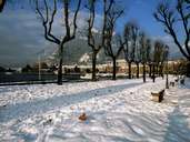
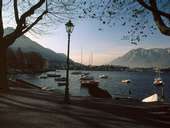
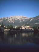
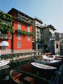
Bildersammlung »Lecco«

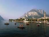
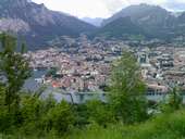
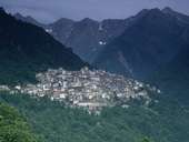
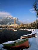
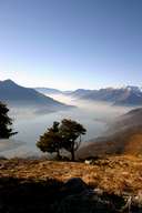
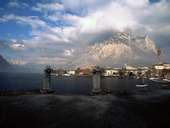
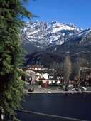
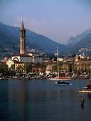
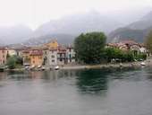
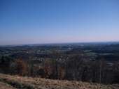
Wo befinden sich der tiefste See, der kürzeste Fluss oder die kleinste Gemeinde Europas? Die Tourismuswerbung "Lario Online" gibt hierauf selbstbewusst (wenngleich nicht unbedingt korrekt) Antwort: in Lecco. Gemeint sind der 410m tiefe Comer See, der nur 250m lange Fluss Fiumelatte und die Gemeinde Morterone mit gerade einmal 29 Einwohnern. Wie unschwer zu bemerken ist, gehört die lombardische Provinz zwar zu den kleineren Nuts-3-Regionen der Alpen, jedoch erwarten den Besucher ein von sich selbst eingenommenes Volk und jede Menge Überraschungen. Weiterlesen →

Tirol Atlas image No.°10180
Lago di Como bei Lecco und Monte Coltignone (1.437m)
Tirol Atlas image No.°11429
Lecco am Monte Melma (914m) und Cima di Muschiada (1.666m)
Tirol Atlas image No.°10188
Bergdorf Premana in den Bergamasker Alpen
Tirol Atlas image No.°10179
Tage mit Schneebedeckung sind im Hauptort Lecco selten
Tirol Atlas image No.°10691
Comer See
Tirol Atlas image No.°10190
Lago di Como bei Lecco
Tirol Atlas image No.°10193
Lago di Como bei Lecco
Tirol Atlas image No.°10183
Lecco mit Lago di Como
Tirol Atlas image No.°10199
Lecco bei Schnee
Tirol Atlas image No.°10185
Die Seepromenade bei Lecco am Comersee
Tirol Atlas image No.°10195
Lago di Como, Provinz Lecco
Tirol Atlas image No.°10191
Lecco, Boote
Tirol Atlas image No.°11577
Fischerstädtchen Rione Pescarenico bei Lecco am Lago di Lecco
Tirol Atlas image No.°10194
In den Orobischen Alpen - eine Siedlung drängt sich am schmalen Talboden
Tirol Atlas image No.°10196
Orobische Alpen
Tirol Atlas image No.°10192
Provinz Lecco
Tirol Atlas image No.°10187
Der Blick in die Poebene scheint unendlich zu sein
Tirol Atlas image No.°10186
Steg, Provinz Lecco
Tirol Atlas image No.°10201
Lago di Como
Tirol Atlas image No.°10189
Lago di Como bei Lecco
Tirol Atlas image No.°11576
Käseproduktion in den lombardischen Alpen
Übersichtskarte
Topografische Karte
  
Weiterführende Links: Weblink »Wikipedia«, tiroLexikon