Image collection »Sterzing/ Vipiteno«
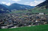
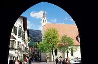
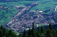
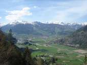
The town of Sterzing is situated in the Sterzinger Basin, the first wide gap south of the Brenner Pass, on the west bank of the Eisack River. In 1931 the villages of Tschöfs and Thuins, with the skiing area on the eastern and southern slopes of the Rosskopf Mountain, were incorporated. The village of Ried on the eastern side of the valley is also part of Sterzing. The medieval centre with the famous Zwölferturm Tower has been a historic junction for traffic over and within the Alps. In Sterzing the roads over the Jaufen Pass and Penser Joch Pass are linked with the road over the Brenner Pass running into the Ridnaun- and Pfitschertal. Sterzing, with its shopping facilities and location of important companies, is the central town in the southern Wipptal.
|
|
|
|
|
|