Image collection »Ahrntal/ Valle Aurina«
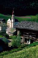
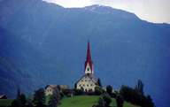
Ahrntal is subdivided into five, formerly administratively independent villages from which Steinhaus forms the centre. Ahrntal, surrounded and protected by the Zillertaler Alps and the Durreck Mountains, stretches from the gorge of the Ahr Torrent, near Sand in Taufers, to the gorge of St. Peter. Several torrents from the steep slopes of the valley flow into the Ahr Torrent. The road in the valley provides the only access to the Ahrntal. Agriculture has lost its former importance when the skiing areas of Klausberg (1971) and Speikboden (1973) were developed and tourists have started to come to the valley.

|

|
|
Further links: Hazards Chronicle Tyrol, Weblink »Ahrntal/ Valle Aurina«, Weblink »Wikipedia«, tiroLexikon
