Image collection »Olang/ Valdaora«
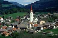
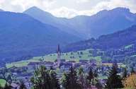
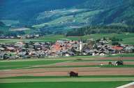
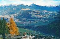
Olang, 9 km east of Bruneck, is situated on the southern bank of the Rienz River in the upper Pustertal and extends till the northern Dolomites Mountain Range. Olang is subdivided into four villages: Unter-, Mitter- and Oberolang are located on the terraced basin in the Pustertal, the scattered settlement Geiselsberg lies on the eastern slope of the Kronplatz Mountain. Olang's economy is characterized by tourism. The beginning of tourism took place in the small spas of Bad Bergfall and Bad Schartl in the 17th and 18th century. Today Olang is a famous winter resort: international and national tobogganing competitions on various runs and the skiing area of Kronplatz are to be found in Olang.
|
|
|
|
|
|