Image collection »Tirol/ Tirolo«
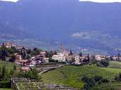
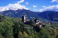
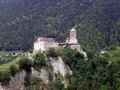
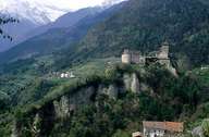
The village of Tirol is subdivided into the settlements of Tirol (administrative centre) and St. Peter and is situated on an ice-age terrace above Meran. The village stretches from the bottom of the Passereiertal to the slopes of the Mutspitze Mountain, which is part of the Texel Mountain Range. Some of the Muthöfe farmhouses on the steep slopes also belong to Tirol. Tirol, which is one of the most important tourist centres in the Burggrafenamt district, is surrounded by large vineyards and orchards. Castle Tirol, which was the seat of the Counts of Tirol and gave the former "land along the Etsch River and in the mountains" its name, is located above the steep Köstengraben Gorge. Since 1973 the castle has belonged to the Province of Bozen and houses the provincial museum for cultural and regional history.
|
|
|
|
|
|