Image collection »Tisens/ Tesimo«
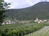
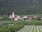
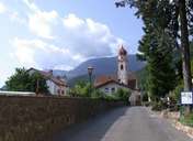
The Tisner Terrace is situated on the western slopes of the central Etschtal and stretches from the Gaul Gorge at the entrance to the Ultental in the north to the Nalser Gorge in the south. The long stretched village of Tisen - along the narrow road - is located on this terrace, surrounded by large orchards. Two roads link the village, which encompasses further settlements, with the Etschtal. A road connects Gfrill with the Gampen Pass, which links the Burggrafenamt with the Nonsberg Valley and its German villages. Small farms run by farmers with an extra job, are typical for the village. The cooperative of fruit farmers in Tisen was founded in 1951.
|
|
|
|
|
|