Image collection »Sexten/ Sesto«
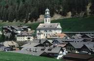
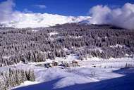
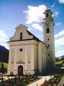
Sexten, the most eastern village in South Tyrol, encompasses the Sexten Tal, which stretches from Innichen south-eastwards. Sexten is framed by the foothills of the Karnischen Alps in the northeast and the Sextener Dolomites Mountain Range in the south. The Kreuzberg Pass links the village with the Piavetal (Veneto). The village is subdivided into the compact settlements of St. Veit (better known as Sexten), Moos and Schmieden at the bottom of the valley, and several clustered farmhouses, such as Außerberg and Mitterberg, on the mountain slopes. In the course of the development of the infrastructure in the Dolomites Mountains in the second half of the 19th century, tourism started in Sexten and has become the main economic sector of the valley since then.
|
|
|
|