Image collection »Schnals/ Senales«
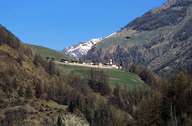
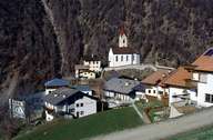
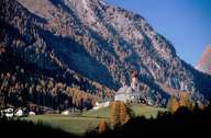
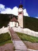
Schnals has one of the largest surface areas of all villages in South Tyrol. The village encompasses the entire Schnalstal (except of the entrance), which has its entrance near Naturns in the Vinschgau Valley in the south. Karthau, the central village and administrative centre, is situated on a terrace on the southern slope of the valley at the site of the former chartreuse Allerengelberg. Schnals furthermore encompasses the historic pilgrimage site of Unser Frau, bellow the Vernagt Reservoir, and the recently expanding settlement of Katharinaberg. The highest alpine pasture lands within the East Alps are to be found in the Schnalstal, with its farms on extremely steep slopes, on which rye was cultivated once. Tourism has become the main source of income since the development of the Schnalstaler Glacier as a ski resort and the upgrading of Kurzras at the end of the valley.
|
|
|
|
|
|