Image collection »S.Cristina/ St.Christina i.G./ S.Cristina V.G.«
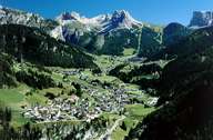
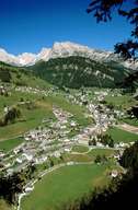
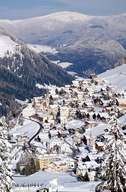
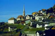
St. Christina is situated in the middle of the three Ladinic villages in the Grödental. St. Christina stretches from either side of the Grödner River up the slopes to the Geißler Mountain Range in the north and the Langkofel Mountain Range in the south. Around the old village centre surrounding the church, a completely different settlement, characterized by tourism, has developed along the road within the last decades. The old farms with their old wooden houses on the sunny slopes have remained from the time, when St. Christina was a rural village. Thousands of tourists visit the skiing areas of Seceda in the north and the one around the Monte Pana in the south.
|
|
|
|
|
|