Image collection »Rodeneck/ Rodengo«
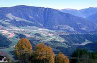
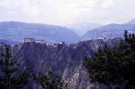
Rodeneck, which is subdivided into several villages, is situated on a wide terrace, 200 m above the Rienz Gorge, northeast of Brixen. The village's name derives from Castle Rodenegg, which lies on a rock high above the Rienz River. The central village of Vill and the villages of Nauders and Gifen form more or less compact settlement units located on the terrace. Scattered settlements are to be found on the south-western slopes below the mountain ridges of the Rodenecker and Lüsener Alm. Dairy farming is very important, which is reflected in the cultural landscape, characterized by pasture lands and fields of fodder corn. Dairy farming, however, is often not the main source of income. Most of the working people have to commute outside the village.
|
|
|