Image collection »Riffian/ Rifiano«
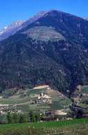
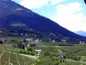
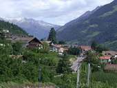
Riffian is situated on the western slopes of the lower Passeiertal, 5 km north of Meran. The long stretched central village is situated on a terrace on the south-eastern slopes. The Vernuer farmhouses are located above. Magdfeld, the remotest settlement of the village, cannot be reached directly from Riffian, but only on the road, which runs through the Passeiertal. Agriculture in the mountain villages of Vernuer and Magdfeld is based on livestock, whereas in the valley around Riffian it is characterized by fruit-growing and vineyards. Riffian and the small neighbouring village of Kuen have formed an administrative unit.
|
|
|
|
Further links: Hazards Chronicle Tyrol, Weblink »Riffian/ Rifiano«, Weblink »Wikipedia«, tiroLexikon