Image collection »Burgstall/ Postal«
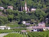
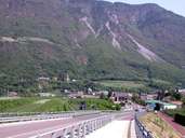
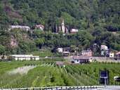
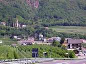
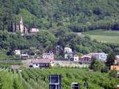
Burgstall is situated on the left bank of the Etsch River, 8 km south of Meran. The old settlement developed at the bottom of the Tschöggl Mountain. In the course of the railway construction by the end of the 19th century the Etsch River was regulated and the former floodplains meliorated and made suitable for fruit-growing, which is today the main source of income for the village. Burgstall has expanded along the road since then. Since the construction of the "MEBO" (motor highway between Meran and Bozen) Burgstall no longer suffers from through traffic.
|
|
|
|
|
|
Further links: Hazards Chronicle Tyrol, Weblink »Burgstall/ Postal«, Weblink »Wikipedia«, tiroLexikon