Image collection »Percha/ Perca«
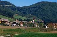
Percha is situated on a plateau, east of the Brunecker Basin. The long stretched Wielental in the north reaches the Riesenfernergruppe Mountain Range. In contrast to the central village of Percha, an expanding suburb of nearby Bruneck with numerous new houses, the settlements on the mountain slopes (Wielenberg, Oberwielenbach, Platten, Aschbach and Nasen) are still characterized by agriculture.
|
|