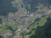
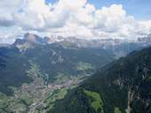
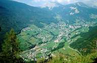
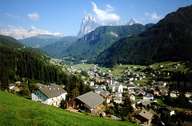
Image collection »Urtijëi/ Sankt Ulrich/ Ortisei«
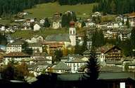
Even though the market town of St. Ulrich (since 1907) is the centre of Gröden, it has the smallest surface area of all villages in the valley. St. Ulrich stretches from the right bank of the Grödner River to the slopes of the Raschötzer Mountain. The southern side of the valley in the area of St. Ulrich belongs to the village of Kastelruth, even though it is economically, culturally and linguistically (Ladinic) orientated towards Gröden. The reason for that is that the two sides of the valley belonged to two different juridical districts. St. Ulrich is one of the chicest tourist resorts in the Alps with excellent tourism related facilities. In 1970 St. Ulrich was the host of the alpine ski world championship.
|
|
|
|
|
|