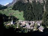
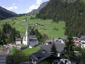
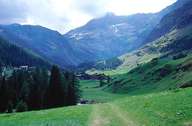
Image collection »Moos i.P./ Moso i.P.«
Moos has the largest surface area in the Passeiertal. The village encompasses two smaller valleys in the west, which extend into the Ötztaler and the Stubaier Alps in the north. The western border of Moos align with the national border of Austria. All settlements in the valley (Pfelders, Rabenstein, Platt, Stuls, Ulfas and Moos) lie above 1000 m. Some farms are located on extremely steep slopes. Even though all settlements are easy to access, they belong to the poorest in South Tyrol. Agriculture and dairy farming are the main sources of income for the village. There are hardly any tourists in the village. However their figures have increased to some extent since the opening of the Timmels-Joch-Road in 1967, which can only be used in the summer months.
|
|
|

|
|
|