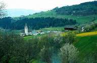
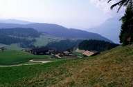
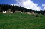
Image collection »Mölten/ Meltina«
Mölten, situated on the Tschögglberg, stretches above the central Etschtal. The village is characterized by sparsely scattered hamlets and isolated farmhouses. Only in the villages of Verschneid and Mölten larger settlements can be found. One reason for that is the panorama road down to the Etschtal which was built only some years ago. Before the construction of the road, a funicular, which was built in 1955 and connected Mölten with Vilpian, had been the only connection. This long seclusion is reflected in a traditional rural landscape and the population structure.
|
|
|
|