Image collection »Martell/ Martello«
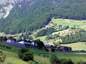
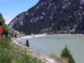
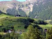
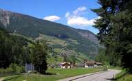
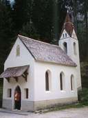
Martell encompasses the 24 km long Martelltal, which has its entrance near Morter in the Vinschgau Valley. The village border is defined by the mountain crests of the valley, through which the Plima River runs. Martell is subdivided into several villages, which, including the administrative centre in Meiern, are situated in the lower part of the valley. Most of the villages with their scattered farms and houses are located either on southerly exposed slopes, fans or terraces. The agricultural sector is the dominating economic sector in Martell, with a focus on livestock and since the 1970's on the cultivation of vegetables and berries. The cooperation tries to help the farmers selling their goods. Strawberry fields can be found up to 1700 m above sea level, which leads to a longer ripening time. Martell, which suffers from a decline in population due to migration, can only be reached on the road on the bottom of the valley.
|
|
|
|
|
|