Image collection »Mareo/ Enneberg/ Marebbe«
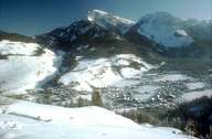
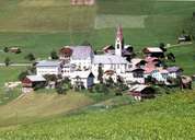
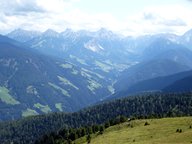
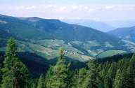
Enneberg has the largest surface area among all Ladinic villages. Enneberg encompasses parts of the western slopes of the Gadertal around the settlement of Wellschellen and the 20 km long Enneberger Tal, which stretches eastwards near Zwischenwasser. The scattered village of St. Vigil, the administrative centre of Enneberg, is situated in the upper part of the Enneberger Tal. Characterized by tourism, it belongs to the best known regions for winter sports (Kronplatz) in South Tyrol and Italy. The cultural landscape of the more rural parts of the lower Gadertal, on the other hand, is characterized by numerous small compact hamlets ("viles"), with their typical architecture, on steep slopes.
|
|
|
|
|
|