Tirol Atlas Archive

tiroLexikon

^UP

Image collection »Lüsen/ Luson«

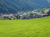
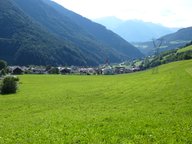
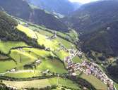
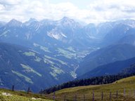
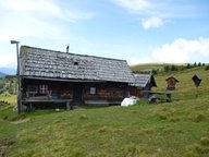
Lüsen encompasses seven settlements. Most of the scattered settlements are situated on the orographic right side of the valley, such as Kreuz, Huben and Berg in the lower part of the valley, Flitt and parts of Petschied on the other hand are situated in the upper valley. The central villages Lüsen and Rungg have developed on a large fan. Three quarters of the area are covered by alpine pasture lands and forest. Lüsen's economy is based on livestock, small businesses and tourism.

Tirol Atlas image No.°11747
en:Lüsen Dorf
Tirol Atlas image No.°11748
en:Lüsen im Lüsner Tal (Blick talauswärts)
Tirol Atlas image No.°6296
Lüssen
Tirol Atlas image No.°11749
en:Lüsen - die Prozession zu Maria Himmelfahrt in der Dorfgasse
Tirol Atlas image No.°11743
en:Blick von der Lüsner Alm in das Enneberger Tal und auf die Pragser Dolomiten
Tirol Atlas image No.°11738
en:Hütte der Astalm auf der Lüsner Alm
Overview map
Topographic map
 
Further links: Hazards Chronicle Tyrol, Weblink »Lüsen/ Luson«, Weblink »Wikipedia«, tiroLexikon