Image collection »Algund/ Lagundo«
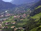
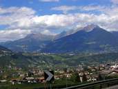
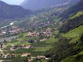
Algund is characterized by its proximity to Meran and is subdivided into seven settlements in two different regions: Aschbach (1350), which can be reached on a relatively new road and Ried on the right bank of the Etsch River, west of the incline to Töll. Mühlbach, situated on the left bank of the Etschh River, has become the centre of Algund. The villages stretch along two fans, which were formed by rivers from the Texel Mountain Range in the north. Fruit farming and tourism are the main sources of income for Algund. One of the largest breweries in Italy is to be found in the village of Forst.
|
|
|
|
|
|