Image collection »Latsch/ Laces«
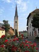
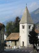
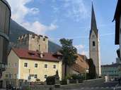
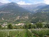
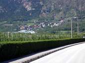
The market town of Latsch, the fourth largest village in the Vinschgau Valley, is situated at the mouth of the Plima River, which runs out of the Martelltal in the southwest. Latsch stretches from either side of the Etsch River up to the mountain crests in the north and the south. The Latschender Enge forms the natural border in the east. The centre lies at the edge of the massive Tarscher Fan, on which the village of Tarsch is situated further uphill. Latsch furthermore includes the villages of Morter, at the entrance to the Martellertal, Goldrain on the right bank of the Etsch River and St. Martin (1500 m) on the Vorberg. Latsch with its numerous castles has an economy based on intensive fruit-growing, industrial enterprises and tourism.
|
|
|
|
|
|
|