Image collection »Gais/ Gais«
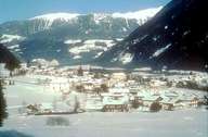
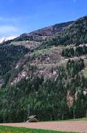
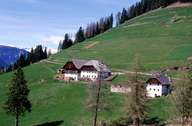
Gais is situated in the lower part of the Tauferertal, which stretches from the Brunecker Basin northwards. The central village of Gais, located at the foot of the Bärentaler Fan, and the scattered village of Uttenheim lie in the bottom of the valley. Other parts of the village, such as Mühlbach and Tesselberg are on the sunny, eastern slopes. Gais" development was linked to its proximity to Bruneck and the road to the Ahrntal. The village's economy is based on tourism, commercial and trading businesses.
|
|
|
|