Image collection »Franzensfeste/ Fortezza«
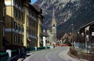
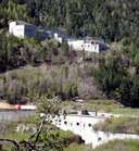
Together with the two villages of Grasstein and Mittewald further up the valley, Franzensfeste encompasses the Sachsenklemme, a narrow (due to the bedrock - Brixner Granite) and less attractive part of the Eisacktal. Franzensfeste was founded here due to its strategic position. The construction of the fortress under the Austrian emperor Franz I. (1833-1838) was never completed, because it was later considered as being useless. Since the construction of the Brenner Railway and the Pustertal Railway, Franzensfeste has become an important traffic junction. This has become even more obvious, when the exit of the Brenner Highway to Brixen and the Pustertal was built in Franzensfeste.

|

|

|
|
