Image collection »Pfalzen/ Falzes«
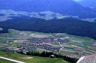
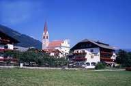
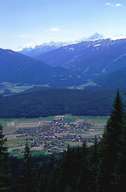
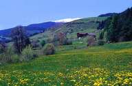
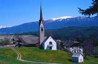
Pfalzen (1000 m) with the villages of Greinwalden and Issing is situated on a terrace west of Bruneck on the northern side of the Pustertal. The mountain crest with the Sambock Peak (2400 m) facing the Mühlwaldertal forms the northern border of Pfalzen. The pine covered granite hill of Unterberg forms a clear edge of the plateau. It marks the southern border of the municipality. Its geographical location with a well developed infrastructure and easy accessibility from three directions have made Pfalzen a popular residential area for former townspeople. This has lead to significant demographic changes in the village. The local economy is based on tourism, trade and agriculture.
|
|
|
|
|
|
|