Image collection »Kurtinig a.d.W./ Cortina s.s.d.v.«
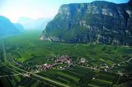
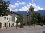
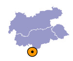
Kurtining, is both the second smallest village in South Tyrol, only consists of one settlement, and also the flattest village (only 4 metres difference in altitude). It has no forest, rocks and it is the most southern village in the province with a German speaking majority. In 1963 Kurtinig regained its political independence, after it had been incorporated with Margreid during the fascistic period. Agriculture is based on fruit-growing. Even though a small trading area has generated some jobs, most people have to commute to Bolzano-Bozen or other neighbouring villages.

|

|
|
