Image collection »Kastelbell-Tschars/ Castelbello-Ciardes«
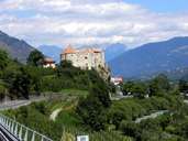
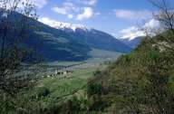
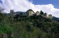
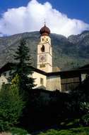
The village of Kastelbell-Tschars is situated on either side of the Etsch River in the lower Vinschgau Valley. The village stretches from the Latschander Gorge in the west to the entrance of the Schnalstal, with the famous Castle Juval, in the east. Hamlets and isolated farmhouses on the Nörder Mountain reach the crest of the Ultner Mountain, whereas fewer settlements are to be found on the dry slopes of the Sonnen Mountain on the other side of the valley. The two scattered villages, which gave the village its name (the administrative centre of Kastelbell and the village of Tschars), are situated within large orchards, which form the basis of the local economy.
|
|
|
|
|
|