Image collection »Sand i.T./ Campo Tures«
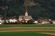
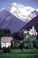
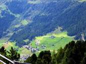
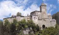
Sand in Taufers is the second largest village in the Tauferer-Ahrntal, a valley northeast of the Pustertal. The village is situated in a wide gap of the Tauferer Boden, from where one reaches the high valleys of Mühlwald and Rein. The market town is subdivided into the central village with the massive Mühlwald Castle and the large Castle Taufers, the villages of Kematen and Mühlen on the bottom of the valley, the scattered farmhouses of Ahornach on the sunny slopes and the settlement of Rein, which is surrounded by the high mountains (above 3000 m) of the Durreck and the Rieserferner Mountain Range (Nature Reserve). Rein with its farmhouses on steep mountain slopes is still characterized by agriculture. At the bottom of the valley on the other hand, commercial and industrial companies can be found.
|
|
|
|
|
|