Image collection »Kaltern a.d.W./ Caldaro s.s.d.v.«
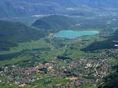
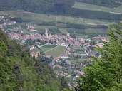
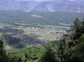
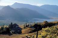
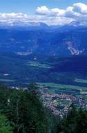
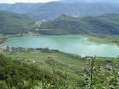
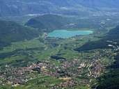
The market town of Kaltern in the Überetsch region is situated at the bottom of the Mendel Mountain Range, which reaches up to 2000 m. The village stretches from the steep slopes of the Mittel Mountain in the east, to the gentle slopes down to the Etschtal in the south. The scattered village includes old, compact centres (Kaltern, Mitterdorf, St. Anton and St. Nikolaus). The Kalterer See is situated south of Kaltern. This is the winegrowing area in the Überetsch region and has been the synonym for South Tyrolean wine for years. Besides vineyards the region is characterized by orchards. In this region, with its mild climate tourism plays an important role.
|
|
|
|
|
|
|
|
|
|