Image collection »Prags/ Braies«
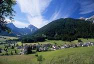
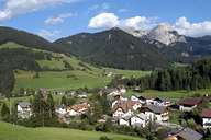
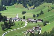
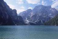
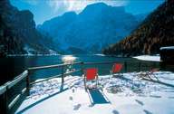
Prags, which is subdivided into several scattered settlements, encompasses the entire Pragser Tal south of the Pustertal, which stretches from the confluence of the Pragser Torrent and the Rienz River to the Pragser Dolomites Mountain Range. Further up, the valley runs in two different directions: Schmieden, the administrative centre, the village of St. Veit and Lake Prags are situated in the region of Innerprags on the orographic right side. On the left side, the valley goes to Außerprags with the old spa of Altprags and ends at the Dürrenstein Mountain. At the foot of the mountain the unique Plätzwiese is situated, which could have been protected from planned tourist developments by incorporating it with the Fanes-Sennes-Prags Nature Reserve.
|
|
|
|
|
|