Image collection »Steinberg a.R.«
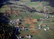
Steinberg is one of the remotest villages within the Northern Limestone Alps. The village, which has been settled since the 8th century, can be reached from Achenkirch on a 10 km long road. Steinberg is situated in a depression within a high valley, sheltered from the wind it is surrounded by the 6 km long Rofan Mountains in the south, the Guffert Mountain in the north and the Unnutz Mountain Massif in the west. The scattered village (with a population of around 300) consists of hamlets and isolated farmhouses. In former times people gained their living from livestock breeding and timber (especially from drafting logs to the Brandenberger Ache River). Today most of the working people commute. The quiet and untouched landscape around Steinberg is a popular destination for day trips.
|
|