Image collection »Stans«
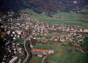
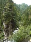
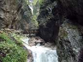
Stans is situated in the centre of the Unterinntal, on the left bank of the Inn River, 2 km northeast of the district capital Schwaz. The centre, which is subdivided into Ober- and Unterdorf, with its striking churches, stretches on the eastern side of the fan of the Stanser Torrent. Furthermore Stans, which is a popular place for living, encompasses 6 more villages, which are all around the historical village. These are all relatively new and have been built in the last decades. The monastery and popular pilgrimage site of Georgenberg, which is located within a rocky gorge, in the north and Castle Tratzberg in the east are the two most important sights in Stans. Stans has a number of large and medium-sized businesses (one of them Darbo, the well known jam and preserves producer) situated in the industrial park of Dornau.
|

|
|
|
|
|