Image collection »Schwaz«
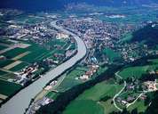
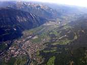
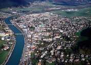
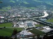
The silver mining town of Schwaz is situated on the fan of the Lahn Torrent, at the foot of Castle Freundsberg, one of the most prominent sights in the Unterinntal. Mining dates back till the Bronze Age. In the 15th century large silver and copper deposits were found, making Schwaz Europe's mining centre till the early 17th century. The market town (since 1331) with its 20,000 inhabitants was Austria's second largest settlement. A show mine, numerous gothic ecclesiastical and secular buildings show the former wealth of Schwaz. The parish church with its two same-sized naves (one for townsmen and one for miners) and the town hall are mentionable. Today Schwaz, which received its city charter in 1899, is the district capital and an educational, social and political centre for the region. Numerous businesses (abradant plant, varnish plant, recycling and waste disposal plant) are located in Schwaz.
|
|
|
|
|
|