Image collection »Rohrberg«
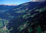
The mountain village of Rohrberg stretches from the bottom of the valley near Zell am Ziller with the two hamlets of Haslach and Rohr, over forests and pasture lands with well developed scattered mountain farmhouses up to the alpine pasture lands. Next to farming two other industries play an important role in the village: The station at the bottom of the ski lift of the "Zillertal Arena" is located in Rohr, and parts of the skiing area are in the alpine pasture lands. The power station Gerlos, which belongs to the AHP (Austrian Hydro Power PLC), is also situated in Rohr. The power station gets its water through a tunnel from the Gmünd Reservoir in the Gerlostal.
|
|